Just 30 minutes east of Portland, the Historic Columbia River Highway threads a wall of waterfalls so dense it’s simply called the Waterfall Corridor. Within a few miles you can stand beneath Oregon’s tallest waterfall, walk behind another, and watch a third plunge over a perfect column of basalt — all without a serious hike.
Multnomah Falls is the headliner, and the rest of the corridor is the reason to stay all day. This guide covers the marquee falls one by one, the summer timed-entry permit that trips up most first-timers, the smartest way to drive the loop, and the quieter stops worth the detour — then you can hear every one of them narrated on a self-guided audio tour as you drive.
- Entrance fee
- Free to visit — but a summer timed-use permit is required to park at the I-84 lot
- Summer permit
- $2 timed-use permit, 9am–6pm daily, May 22 – Sep 7, 2026 (I-84 Exit 31 lot) via Recreation.gov
- Where
- ≈30 min east of Portland on I-84 / the Historic Columbia River Highway
- Don’t-miss
- Multnomah · Wahkeena · Horsetail · Latourell · Bridal Veil
- The drive
- The Historic Columbia River Highway (US-30) strings the falls together
- Cell signal
- Decent at Multnomah; patchy in the side canyons — download first
- Best season
- Spring for peak flow; fall for color; winter for ice and solitude
Book the Multnomah Falls audio tour
Plays itself by GPS as you drive, narrating every fall and overlook. Works offline.
See the full tour, stops & map →Top things to see & do
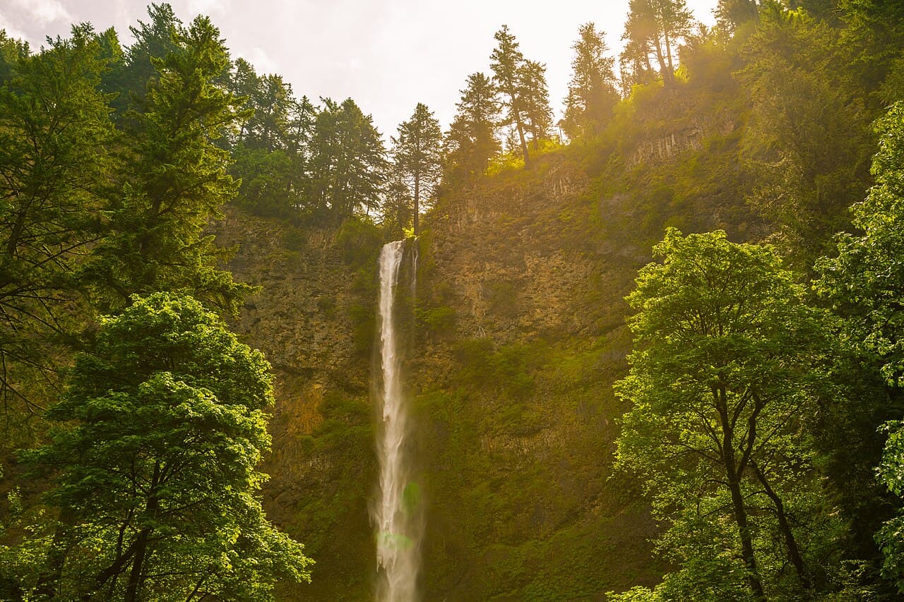
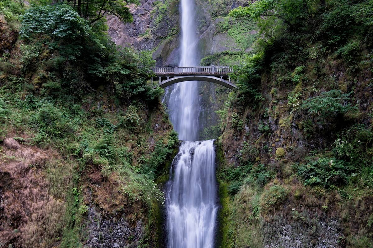
Multnomah Falls
At 620 feet, Multnomah is the tallest waterfall in Oregon and the most-visited natural site in the state. It falls in two tiers — a long upper plunge and a shorter lower drop — with the historic Benson Bridge spanning the gap, the postcard view almost everyone comes for.
A flat, paved path leads from the lodge to the bridge in about five minutes. For the big payoff, a 1.2-mile switchback trail climbs to a viewing platform at the very top, looking straight down the falls and out over the Gorge.
Pro tip: In summer the I-84 lot needs a $2 timed-use permit (book it on Recreation.gov ahead of time). No permit? Come before 9am or after 6pm, or park along the Historic Highway and walk in.
Read the full Multnomah Falls guide →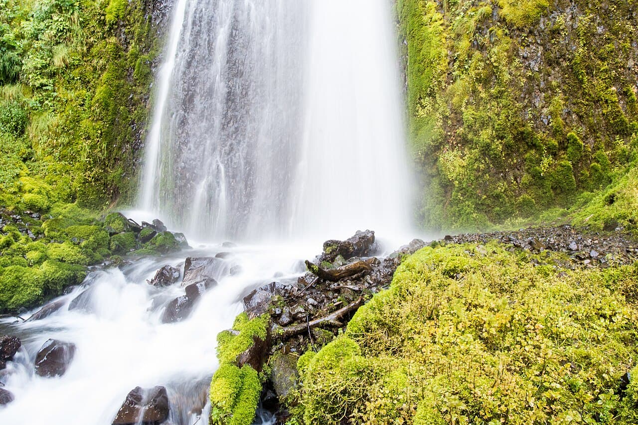
Wahkeena Falls
Just half a mile west of Multnomah, Wahkeena is a 242-foot cascade that tumbles in a series of mossy steps rather than a single plunge — a softer, more intimate counterpoint to its famous neighbor. The name means “most beautiful” in the Yakama language.
A stone footbridge crosses the creek a short walk from the road. For a classic Gorge hike, the 5-mile Wahkeena–Multnomah loop links the two falls along the forested benches above the highway.
Pro tip: Park at Wahkeena (no summer permit needed here) and hike the loop to Multnomah — you’ll skip the permit hassle and see both falls from angles the crowds never do.
Read the full Wahkeena Falls guide →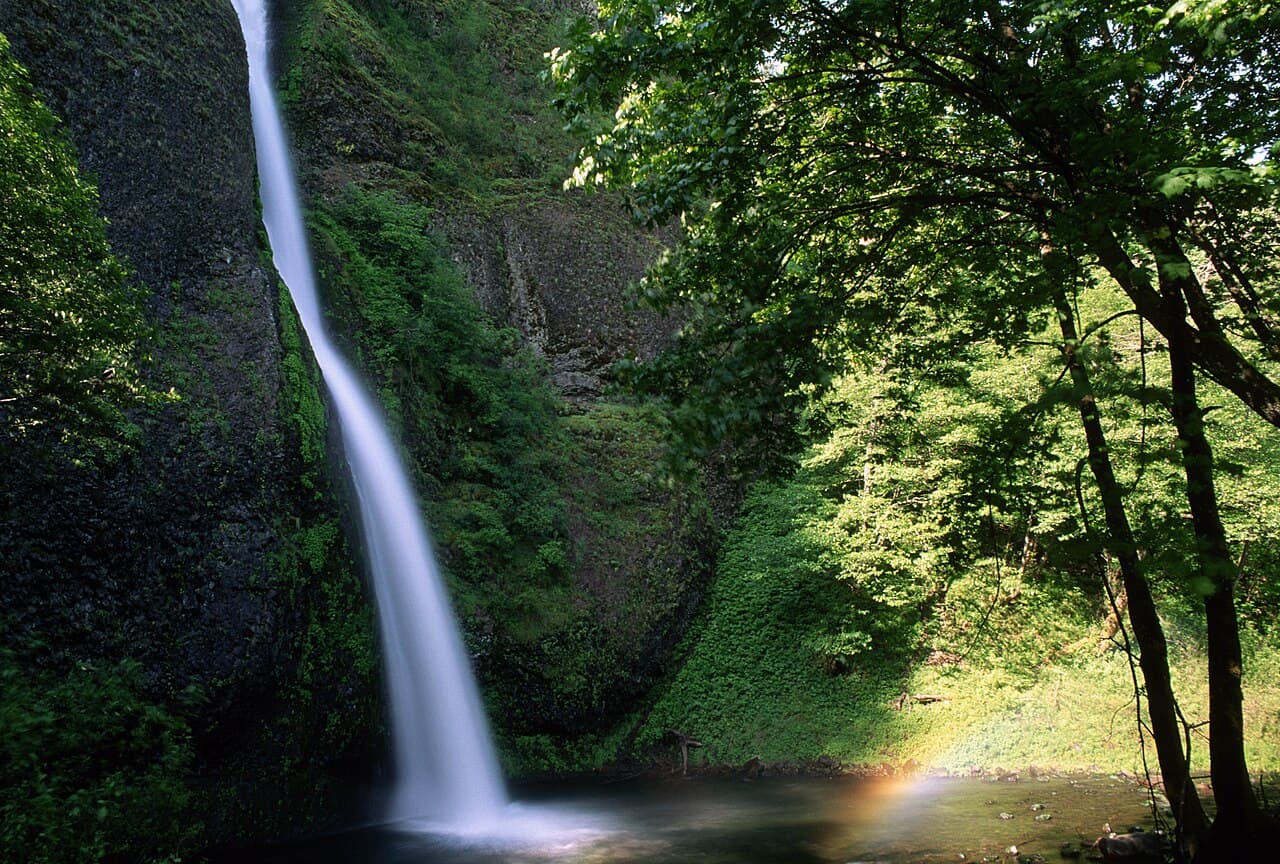
Horsetail & Ponytail Falls
Horsetail Falls drops 176 feet in a single graceful plume right beside the Historic Highway — you can photograph it without leaving the parking lot. But the real treat is the short climb above it.
A switchback trail leads to Ponytail Falls (Upper Horsetail), where the path passes through a recess scooped into the cliff so you walk directly behind the falling water — the same trick Hocking Hills’ recess caves play, but with a waterfall in front of you.
Pro tip: Continue past Ponytail and the trail leads toward the Oneonta area and Triple Falls — a longer, quieter hike most roadside visitors never attempt.
Read the full Horsetail & Ponytail Falls guide →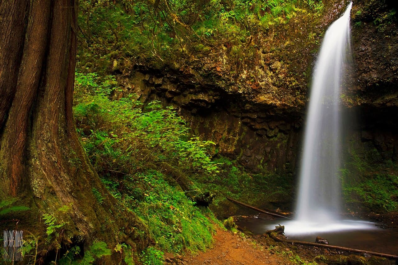
Latourell Falls
The westernmost of the marquee falls, Latourell is also the most distinctive: a 249-foot ribbon that free-falls straight off an overhanging wall of columnar basalt splashed with vivid yellow-green lichen. Because the water leaves the cliff cleanly, you can walk right to its base.
Latourell sits in Guy W. Talbot State Park, so unlike Multnomah it’s genuinely a state park — and it’s usually far less crowded. A short paved path reaches the lower-falls viewpoint; a 2.3-mile loop climbs to the upper falls.
Pro tip: Start your corridor day here at the west end and drive east — Latourell’s lot is small and empties of crowds early, and the morning light hits the basalt beautifully.
Read the full Latourell Falls guide →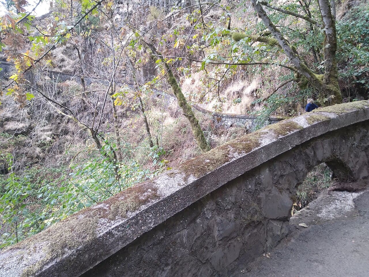
Bridal Veil Falls
A two-tiered, roughly 120-foot waterfall reached by a short trail that switchbacks down from the Historic Highway. Bridal Veil is gentler and less crowded than the headline stops — a satisfying stretch of the legs between the bigger falls.
Bridal Veil Falls State Scenic Viewpoint also has a separate, nearly flat interpretive loop along the clifftop with a camas wildflower meadow and Gorge overlooks — a lovely option if the stairs down to the falls aren’t for you.
Pro tip: Do both short trails here: the descent to the falls and the level overlook loop. Together they’re under a mile and show off two completely different sides of the Gorge.
Read the full Bridal Veil Falls guide →The perfect one-day plan
- 8:30 a.m.Start at Multnomah Falls
Open with the headliner before the crowds (and clear the summer permit if it’s a midday in season). Paved walk to Benson Bridge, or climb to the top.
- 10:00 a.m.Horsetail & Ponytail Falls
Just east: roadside Horsetail, then the short climb to walk behind Ponytail. Peek toward Oneonta Gorge if you have the energy.
- 11:30 a.m.Wahkeena Falls
Head west on the Historic Highway to the mossy cascade — or hike the Wahkeena–Multnomah loop for the big day.
- 12:30 p.m.Bridal Veil Falls
Short trail down to the two-tiered falls, plus the level overlook loop with its camas meadow. A good lunch stop.
- 2:00 p.m.Latourell Falls
The westernmost falls — a clean plunge over columnar basalt in Guy W. Talbot State Park, with Shepperd’s Dell on the way.
- SunsetVista House at Crown Point
Finish on the bluff at the 1918 Vista House for a sweeping sunset down the whole Gorge — the same grand finale the audio tour drives to.
Hidden gems most visitors miss
Vista House at Crown Point
A 1918 stone “observatory” perched 700 feet above the river, with one of the grandest views in the Gorge. Free to enter, with interpretive displays and a gift shop. Spectacular at sunset.
Oneonta Gorge
A narrow slot canyon famous for its mossy walls and end-of-canyon waterfall. Access has been affected by the 2017 Eagle Creek Fire and a large logjam, and conditions change — check current status before attempting it, and never wade in high water.
Wahclella Falls
A 2-mile round-trip up Tanner Creek to a powerful, amphitheater falls — one of the best moderate hikes in the Gorge and far quieter than the roadside stops.
Shepperd’s Dell
A delicate falls in a fern-draped grotto right off the Historic Highway, with a graceful 1914 arch bridge. A quick, easy, photogenic stop most people drive right past.
Angel’s Rest
A steep but rewarding 4.6-mile round-trip hike to a rocky promontory with a 270-degree view up and down the Columbia. Best for those wanting to earn a bigger payoff.
Best time to visit
Spring (Mar–May)
Peak flow + wildflowers
Snowmelt and rain put every fall at full power, and the Bridal Veil camas meadow blooms. The summer permit isn’t in effect for most of spring.
Summer (Jun–Aug)
Long days — and the permit
Warm, busy, and the I-84 timed-use permit is required midday. Book ahead, start early at the west end, or hike in from Wahkeena.
Fall (Sep–Nov)
Color in the canyons
Big-leaf maples turn the side canyons gold. The permit window ends in early September; crowds ease after.
Winter (Dec–Feb)
Ice, mist, and solitude
A hard freeze can rime the falls in ice and you’ll have the corridor nearly to yourself — but watch for ice on the highway and trails, and occasional closures.
Know before you go
What to pack
- ✓ A booked timed-use permit (screenshot it) if visiting Multnomah midday in summer
- ✓ Downloaded offline maps and audio — signal is patchy in the side canyons
- ✓ Layers and a rain shell — the Gorge makes its own weather
- ✓ Grippy shoes — paved paths near the falls stay wet and slick
- ✓ Water and snacks (the Multnomah lodge is the main food option)
- ✓ A camera or charged phone + power bank
- ✓ Microspikes if you’re visiting in an icy spell
- ✓ Patience for parking — lots are small and fill early
Getting there & parking
The corridor sits along I-84 and the parallel Historic Columbia River Highway (US-30), about 30 minutes east of Portland. Multnomah Falls has its own marked exit (I-84 Exit 31) as well as a Historic Highway pull-off.
From roughly late May to early September, the I-84 Multnomah Falls lot requires a $2 timed-use permit between 9am and 6pm, reserved on Recreation.gov up to 14 days ahead (with a smaller batch released 2 days ahead). The permit covers one vehicle but does not guarantee a spot.
The other falls — Wahkeena, Horsetail, Latourell, Bridal Veil — have their own trailhead lots on the Historic Highway and do not require the Multnomah permit. Driving the Historic Highway as a loop lets you string them all together; the lots are small, so go early.
Accessibility
- ♿ Multnomah Falls’ lower viewing plaza and the lodge are accessible; the trail to Benson Bridge and the top is not.
- ♿ Latourell’s lower-falls viewpoint is a short, largely accessible paved path.
- ♿ Bridal Veil’s overlook loop is mostly level; the trail down to the falls has stairs and a climb.
- ♿ Most upper trails involve sustained grades, stairs, and uneven, often-wet rock.
With kids & dogs
- • Great with kids: Multnomah (paved to the bridge) and Ponytail (walking behind the falls) are the biggest hits.
- • Leashed dogs are welcome on the paved areas and trails throughout the corridor.
- • Keep children close on the upper trails and at clifftop overlooks like Vista House and Angel’s Rest.
- • Never wade into Oneonta Gorge or creeks in high or cold water — currents and logjams are dangerous.
Official resources & permits
- Reserve the Multnomah Falls timed-use permit (Recreation.gov) ↗
Book the $2 summer I-84 parking permit — required 9am–6pm, May 22 – Sep 7, 2026.
- Waterfall Corridor Permits (Oregon DOT) ↗
Official overview of the permit system, dates, and free in-person pickup options.
- Multnomah Falls Area (US Forest Service) ↗
Conditions, closures, and trail status from the Columbia River Gorge National Scenic Area.
Where to stay & eat
🛏 Where to stay
- Troutdale / Gateway to the Gorge
The closest cluster of hotels at the corridor’s west end, 10–15 minutes from the falls and an easy hop from Portland.
- Hood River
A lively riverside town about 30 minutes east — breweries, restaurants, and lodging, and a great base for exploring further into the Gorge.
- Portland
Many visitors day-trip from the city, 30–40 minutes west, with the full range of places to stay and eat.
🍽 Where to eat
- Multnomah Falls Lodge
The historic stone lodge at the base of the falls has a sit-down restaurant and a snack bar — the only real food inside the corridor.
- Troutdale & Corbett
Cafés, a brewery, and casual spots at the west end where the Historic Highway begins.
- Hood River
The Gorge’s food-and-drink hub to the east when you want a proper meal after a day of falls.
Frequently asked questions
- Do I need a permit for Multnomah Falls?
- In summer (roughly May 22–Sep 7, 2026), a $2 timed-use permit is required to use the I-84 Exit 31 lot from 9am to 6pm, booked on Recreation.gov. Outside those hours/dates, or arriving via the Historic Columbia River Highway and the other trailheads, no permit is needed.
- How do I see all the waterfalls in one day?
- Drive the Historic Columbia River Highway as a loop and hit them west-to-east: Latourell, Bridal Veil, Wahkeena, Multnomah, then Horsetail. It’s a full but relaxed day, and a self-guided audio tour narrates each stop as you drive.
- Which waterfall can you walk behind?
- Ponytail Falls (Upper Horsetail) — a short, steep trail from the Horsetail lot passes through a recess directly behind the water.
- Is Multnomah Falls free?
- Yes, it’s free to visit. The only cost is the $2 summer timed-use parking permit for the I-84 lot during permit hours.
- When is the best time to visit?
- Spring for the most powerful flow, fall for color and thinner crowds, and winter for ice and solitude. Summer is busiest and requires the midday permit at Multnomah.
- Are dogs allowed?
- Yes — leashed dogs are welcome throughout the corridor, on the paved areas and the trails.
