Marymere Falls is reached by an easy forest hike of about one and three-quarter miles round trip from the Storm King ranger station, mostly flat with a short climb at the end. The shaded trail follows Barnes Creek through old-growth forest and crosses two wooden footbridges before reaching a fern-draped grotto, where Falls Creek drops roughly ninety feet. A small loop at the top offers two viewpoints. The strenuous, rope-assisted Mount Storm King trail also departs from this trailhead and is recommended for experienced hikers only.
Trade the highway noise for birdsong, because the next bit is on foot, and it's a gentle one. From the Storm King ranger station an old-growth path sets off into the trees, about a mile and three-quarters there and back, mostly flat the whole way with just one short climb saved for the very end. It's a true family walk; little legs and tired legs both manage it fine. You'll wind along Barnes Creek under towering firs and cedars, with ferns crowding the edges and moss hanging off every branch like green rags, and you'll cross two wooden footbridges over the rushing water — stop on one and you can feel the cool coming up off the creek. Then the trail tips up that last short stretch and delivers you straight into a green grotto, walls dripping with fern and moss, where Falls Creek comes off Aurora Ridge and drops about ninety feet in a single silver thread. A small loop at the top gives you two viewpoints, so take both. The payoff here is wildly out of proportion to the effort, which is exactly why I love sending people up it. One thing to be clear about before you go. The trail up Mount Storm King also starts from here, and you may see hikers heading for it, but that is a steep, strenuous scramble with ropes bolted to the rock for the final pitch, and it's for experienced hikers only. It is not this tour's path. Admire that peak from down here where it's safe, point your camera up at it, and keep your boots pointed toward the falls. Take your time, and enjoy the walk.
Photo: Sea Cow (Wikimedia Commons user) · CC BY-SA 4.0
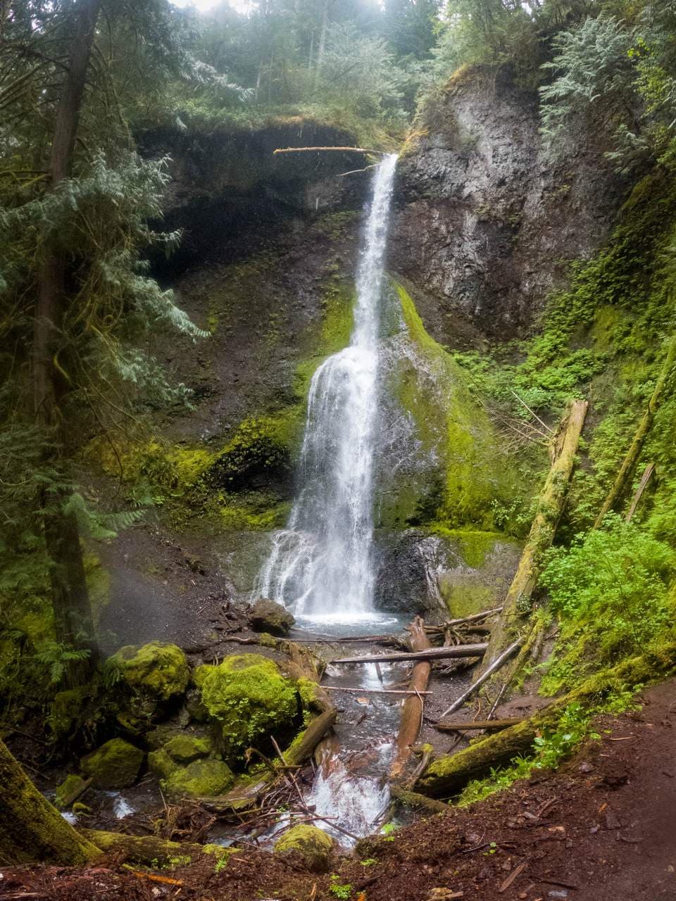
Marymere Falls is a graceful 90-foot waterfall where Falls Creek spills off the slopes of Aurora Ridge into a mossy, fern-lined ravine near the south shore of Lake Crescent. The short trail to reach it is one of Olympic National Park's most beloved easy hikes, winding through towering old-growth Douglas fir, hemlock, and bigleaf maple draped in moss. A footbridge over Barnes Creek and a short climb lead to viewing platforms looking up at the falls.
The walk is gentle and well maintained for most of its length, with the only real effort coming on the short loop of steps and switchbacks at the end that climb to the upper and lower viewpoints. Because it pairs ancient rainforest, a clear creek, and a classic cascade in under two miles, it is ideal for families and first-time park visitors. The falls run year-round and are especially full in spring and after rain.
- • Trail distance: about 1.7-1.8 miles round trip with roughly 400-500 feet of elevation gain; rated easy to moderate.
- • Time needed: plan about 1 to 1.5 hours round trip, more if you linger at the viewpoints.
- • Getting there: starts at the Storm King Ranger Station off US-101 on the south side of Lake Crescent, about 20 miles west of Port Angeles.
- • Fees: covered by the $30 per vehicle 7-day Olympic National Park pass.
- • Pets are not allowed on the Marymere Falls trail, as on nearly all Olympic National Park trails.