Far to the northwest, the peninsula ends at Cape Flattery on Makah land at Neah Bay — outside the park, so a park pass won't work; a Makah recreation permit runs about twenty dollars. Along the park's wild northwest coast lies Ozette, a Makah whaling village buried by a mudslide roughly five centuries ago and exposed again by a 1969 to 1970 storm, then excavated in a Makah-led dig. The collection is kept by the Makah at their museum in Neah Bay; the protected site itself is not a drive-up stop.
Look northwest, off past the timber, toward the far corner of the map. You're not driving out there today — that country runs another world away, to where the whole peninsula finally ends at Cape Flattery, the northwesternmost point of the lower forty-eight. But it's worth knowing about, because tucked along that wild, roadless coast inside the park is one place that carries a truly extraordinary story, and I don't want you to miss it just because the road doesn't go there. First, a practical word if the far northwest ever pulls you back this way. Cape Flattery and the town of Neah Bay sit on sovereign Makah land, and that's outside the national park — so your park pass won't get you in. Instead you buy a Makah recreation permit, about twenty dollars, sold right in town, and it's well worth it for the lighthouse view and the trail out to the cape. Keep that in your back pocket for another trip. What I do want you to hear right now is the story of a Makah village called Ozette — a place the sea itself buried, and then, centuries later, gave back. It's one of the most remarkable things on this entire coast, and it belongs to the Makah, who keep it alive to this day. Stay where you are, let the road roll easy, and Ranger Boone Merrick will tell you about the village the sea kept.
Photo: Konrad Roeder (Kgrr) · CC BY 3.0
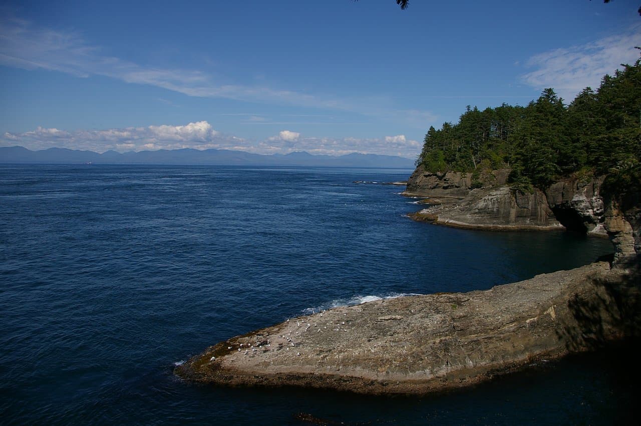
Tucked into the remote northwest corner of the Olympic coast, Lake Ozette is the gateway to the Ozette Triangle, a roughly 9-mile loop that runs out to the ocean via the Cape Alava and Sand Point trails, mostly on cedar-plank boardwalk through ancient forest, with about three miles of wild beach in between. Cape Alava is the westernmost point in the contiguous United States, and the coast here is studded with sea stacks, tide pools, and, along the Wedding Rocks, Makah petroglyphs carved into the shoreline boulders.
This coast is the ancestral home of the Makah people, and near Cape Alava lies the Ozette archaeological site, one of the most significant digs in North America. Around 1750 a massive mudslide buried part of a Makah whaling village, sealing and preserving longhouses and tens of thousands of everyday objects. An 11-year excavation beginning in the 1970s, led with the Makah Tribe, recovered more than 55,000 artifacts, many now displayed at the Makah Museum in Neah Bay. It is, fittingly, the village the sea both took and kept.
- • Getting there: it is a long, remote drive to the Ozette Ranger Station at the north end of Lake Ozette, well off US-101 via Clallam Bay and Sekiu; allow extra time and fuel.
- • Trail: the full Ozette Triangle loop is about 9 to 9.4 miles, with two roughly 3-mile boardwalk legs and a 3-mile beach stretch; moderate, but boardwalks are slick when wet and the beach section is tide-dependent.
- • Tides: a tide table is mandatory. The beach leg between Cape Alava and Sand Point must be timed for lower tides, as headlands can be impassable at high water.
- • Fees and permits: Olympic National Park pass applies ($30 per vehicle, 7 days); day hiking needs no extra permit, but overnight backpacking requires a wilderness permit, a reservation in peak season, and an approved bear canister.
- • Pets and respect: dogs are prohibited on this wilderness route. Do not touch or make rubbings of the Wedding Rocks petroglyphs, and leave all artifacts in place; the Makah Museum in Neah Bay displays the Ozette finds.