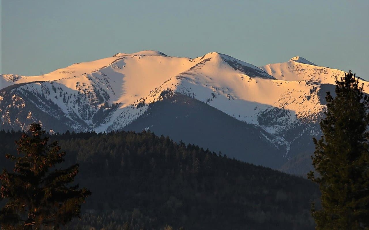
Heading west out of Port Angeles, you cross one of the sharpest climate divides in North America: the Olympic rain shadow. On the sheltered, leeward side the town of Sequim collects only about sixteen inches of rain a year — a sunny near-desert that locals call the blue hole. Yet beyond the mountains, the windward rainforest valleys drink nearly twelve feet. The wall of peaks ahead is what splits the two, and you'll drive from the dry side into the wet one in a single day. How those storms build the park's glaciers and forests is the high country's story.
That wall of mountains filling the windshield ahead — that's not just scenery. That's the machine that writes the weather for everything you'll see today, and it's worth understanding before we climb into it. Here's the short of it. Wet storms come barreling in off the Pacific from the southwest, heavy with ocean, and when they hit this high country they've got nowhere to go but up — and they wring themselves out on the far side of the range. We'll get to exactly how that works, and what it builds, when we're up among the peaks. What I want you to feel right now is the other end of it — this side, the dry side, the side you're driving on. Because here in the lee of the range — the sheltered side — almost nothing's left to fall. The town of Sequim, just back behind you, gets only about sixteen inches of rain a year. That's near-desert. Sunshine an hour's drive from a rainforest. The locals even have a name for the patch of clear sky that hangs over them while everyone else gets soaked — they call it the blue hole. The rainforest valleys on the far side? They drink nearly twelve feet a year. Sixteen inches here, twelve feet there, one range standing between them. And today you get to drive from the dry side clean into the wet one. Now, I'm aimed west and south with you toward the heart of all this, but I'll be honest about what we're leaving out. Off behind us the park wraps on around the Hood Canal — quiet old-growth country, the homeland of the Skokomish people, and part of that country is closed for now after a recent wildfire. We won't reach it on this drive. But what's ahead is the main event. Keep your eye on those mountains. They're about to do something remarkable to the air.
Photo: Richard Probst (Shot in a Frame) · CC BY 2.0
The Olympic rain shadow is one of the most dramatic climate contrasts in the Lower 48. Moisture-laden air sweeps in from the southwest Pacific and slams into the Olympic Mountains, which force it upward until it cools and wrings out its rain on the western slopes. By the time that air descends the northeastern side, it has little moisture left, leaving Sequim, Port Angeles, and the San Juan Islands surprisingly sunny and dry.
The numbers tell the story. The Hoh Rainforest on the southwest side soaks up roughly 140 inches of precipitation a year, and Forks sees well over 120 inches, while Sequim, only about 90 miles away, averages just 16 to 18 inches. Port Angeles sits around 25 to 30 inches. This single mountain barrier creates lush temperate rainforest on one flank and near-Mediterranean dryness on the other, all within a short drive across the peninsula.
- • There is no single 'rain shadow' trailhead; it is a regional effect best appreciated by driving between Sequim/Port Angeles (dry NE) and the Hoh or Forks (wet SW).
- • Olympic National Park charges $30 per vehicle for a 7-day pass; the dry NE towns themselves are free to explore.
- • Best time to experience the contrast is any season, but summer makes the difference most visible as the NE corner stays sunny while the coast stays misty.
- • Sequim's dryness fuels its famous lavender farms (peak bloom in July) and makes it a reliable basecamp when the rest of the peninsula is wet.
- • Allow a half to full day if you want to drive from the dry side to the rainforest side to feel the change firsthand.