Ranger Tales
Ding Darling: Sanibel's Wildlife Drive
Driving tourSanibel Island, FloridaWorks with CarPlay

Ding Darling: Sanibel's Wildlife Drive

27 stops· 50 min· 6.4 mi· narrated by Ranger Quinn

🎧 Hear a preview
0:00 / —:—

Narrated by Ranger Quinn

Buy the self-guided tour now, or get it in the app.

🎫 One-time purchase♾️ Yours forever — no expiry📡 Works fully offline🚗 Apple CarPlay
For birders

The "Ding Darling Big 5"

Serious birders come to Sanibel for the refuge’s five signature species — the ones on every "Ding" Darling checklist. The Wildlife Drive gives you a real shot at all five, and the tour tells you exactly where and when to look.

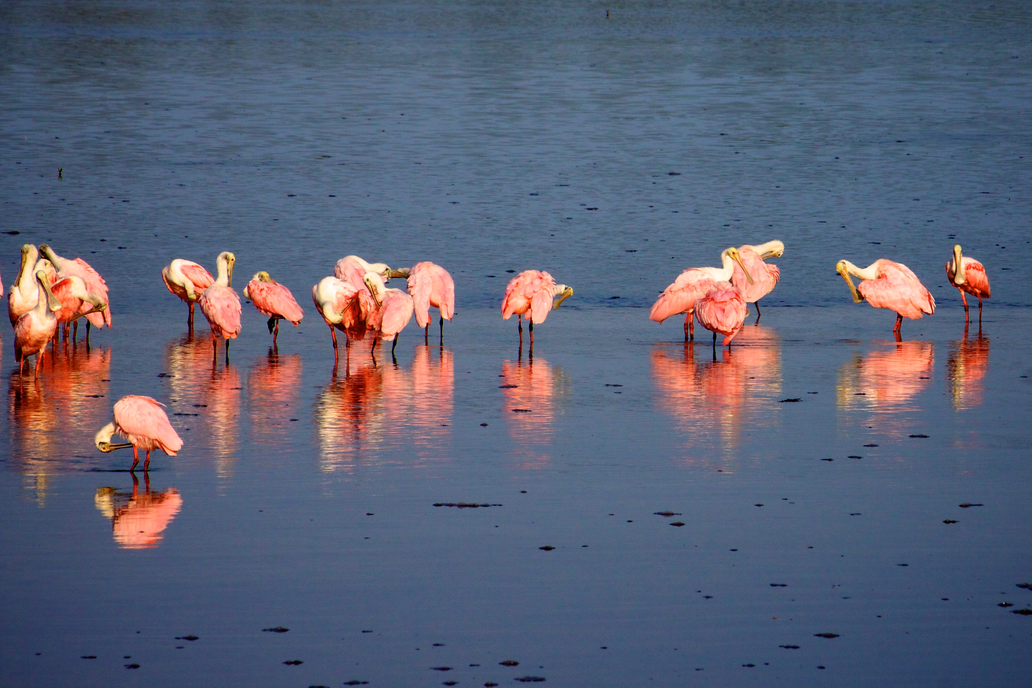
  1. 1Roseate Spoonbillthe pink icon, sweeping its spoon-shaped bill through the shallows
  2. 2Reddish Egretthe "drunken dancer," lurching and canopy-feeding after fish
  3. 3American White Pelicanwinter flotillas drifting across the flats
  4. 4Yellow-crowned Night Heronnests right near the Drive’s exit (April–June)
  5. 5Mangrove Cuckoothe secretive one — patience required (best chances in May)
Highlights include
  • The Wildlife Drive — Welcome to the Refuge
  • The Indigo Trail — On Foot Into the Refuge
  • The Man Who Drew a Duck
  • Into the Mangrove Shade
  • The Mosquito War
  • The Birds You Came For
  • The Observation Tower & the Feeding Flats
  • The First Bench — Reading the Water
The tour

One of the great birding drives in America — the four-mile Wildlife Drive through the J.N. 'Ding' Darling National Wildlife Refuge on Sanibel Island, where the tide pulls back to bare the mudflats and the wading birds come in by the hundreds: roseate spoonbills like flying sunsets, reddish egrets dancing for fish, white pelicans, wood storks, herons and egrets of every kind. Ranger Quinn drives you slowly through the mangrove estuary, tells you what you're looking at and the one trick that makes or breaks the trip — the tide — and points out the alligators, the mangroves, and the birds along the way. Ranger Boone Merrick rides along with the tales: the newspaper cartoonist named Ding Darling who drew a duck, invented a stamp, and quietly saved this island and helped build the whole national refuge system; the Calusa shell kings who ruled this coast without ever planting a crop, and turned back a Spanish conquistador; the shell-hunter's stoop and the one rule that can cost you five hundred dollars; and how the island came back after Hurricane Ian. A slow, gentle, one-way drive — best at LOW TIDE, in the cool months, closed Fridays. Bring binoculars, patience, and a full memory card.

The route

Driving + walking route · 27 stops. Live GPS playback and turn-by-turn pins are in the app.

Every stop

What you'll see and hear

27 narrated stops along the way — waterfalls, overlooks, history, and Ranger Boone's campfire tales.

  1. The Wildlife Drive — Welcome to the Refuge
    01

    🥾 The Wildlife Drive — Welcome to the Refuge

    The entrance to the J.N. 'Ding' Darling National Wildlife Refuge Wildlife Drive on Sanibel Island — the addressable start, where a slow four-mile one-way route into a great mangrove wilderness begins.

    The Wildlife Drive — Welcome to the Refuge guide →
  2. The Indigo Trail — On Foot Into the Refuge
    02

    🥾 The Indigo Trail — On Foot Into the Refuge

    The foot-trail into 'Ding' Darling NWR — a flat two-mile shell dike (four-mile round trip) through mangrove and marsh, best at low tide and early morning. Bring water, sun protection, and bug spray.

    The Indigo Trail — On Foot Into the Refuge guide →
  3. The Man Who Drew a Duck
    03

    🔥 The Man Who Drew a Duck

    Jay Norwood 'Ding' Darling — the newspaper cartoonist who invented the Duck Stamp, ran the nation's wildlife service, and personally saved this island — the whole reason there's a refuge here at all.

    The Man Who Drew a Duck guide →
  4. Into the Mangrove Shade
    04

    🌲 Into the Mangrove Shade

    The shady opening stretch: a mangrove boardwalk past black-mangrove breathing roots, sea oxeye and glasswort, out to the Wildlife Drive crossing.

    Into the Mangrove Shade guide →
  5. The Mosquito War
    05

    🔥 The Mosquito War

    Boone's tale of Sanibel's legendary mosquitoes and the dikes raised to fight them — the mosquito-control impoundments that accidentally became Florida's finest bird table.

    The Mosquito War guide →
  6. The Birds You Came For
    06

    🎧 The Birds You Came For

    Let me arm you with a few birds to look for as you creep along, because knowing what you're seeing makes all the difference out here. Birders talk about the Ding Darling 'Big Five' — five special birds people come hop…

    The Birds You Came For guide →
  7. The Observation Tower & the Feeding Flats
    07

    🌲 The Observation Tower & the Feeding Flats

    The refuge's observation tower, overlooking the main feeding impoundment — the signature stop of the Wildlife Drive, where at low tide the wading birds gather to feed in the hundreds.

    The Observation Tower & the Feeding Flats guide →
  8. The First Bench — Reading the Water
    08

    🌲 The First Bench — Reading the Water

    A bench over open water, and how to read a bird flat — plus how to share the bank safely with a basking alligator.

    The First Bench — Reading the Water guide →
  9. The Birds That Were Almost Hats
    09

    🔥 The Birds That Were Almost Hats

    How the beautiful wading birds you're watching — the egrets and spoonbills — were slaughtered nearly to extinction to decorate ladies' hats, and how the fight to save them gave birth to bird protection itself.

    The Birds That Were Almost Hats guide →
  10. Reading the Water
    10

    🎧 Reading the Water

    I told you at the start that the tide is everything out here, so let me help you actually read the water as you go, because once you see it, you'll never un-see it. Look at where the waterline sits against the banks a…

    Reading the Water guide →
  11. The Kings Who Built With Shells
    11

    🔥 The Kings Who Built With Shells

    The Calusa — the powerful people who ruled this whole coast for centuries without ever planting a single crop, built islands out of seashells, and turned back the conquistador Ponce de León.

    The Kings Who Built With Shells guide →
  12. The Tourist Tree
    12

    🔥 The Tourist Tree

    Boone on the gumbo-limbo, the peeling 'tourist tree' — the living fence you can plant as a post and watch take root.

    The Tourist Tree guide →
  13. The Dike and the Impoundments
    13

    🎧 The Dike and the Impoundments

    Walking the raised dike between managed impoundments — how the refuge works the water to set the table for the birds.

    The Dike and the Impoundments guide →
  14. Watching and Photographing Well
    14

    🎧 Watching and Photographing Well

    A few tips to help you actually catch these birds, whether it's with a camera or just your own two eyes, because a little know-how goes a long way out here. First and most important: patience beats everything. The fol…

    Watching and Photographing Well guide →
  15. The Great Impoundment — the Bird Tables
    15

    🌲 The Great Impoundment — the Bird Tables

    The great shallow impoundment and its low-tide mud flats — ibis, spoonbills, egrets, and wintering pelicans and wood storks by the hundred.

    The Great Impoundment — the Bird Tables guide →
  16. The Gator Hole
    16

    🔥 The Gator Hole

    Boone on the alligator as the marsh's keeper — the dry-season 'gator hole' that becomes an ark for every creature until the rains return.

    The Gator Hole guide →
  17. The Mangrove Overlook
    17

    🌲 The Mangrove Overlook

    A boardwalk overlook into the red mangroves — the walking, salt-drinking trees on their tangled prop roots that build and hold this whole coast and nurse half the life in the Gulf.

    The Mangrove Overlook guide →
  18. The Cross Dike and the Overlook
    18

    🌲 The Cross Dike and the Overlook

    The Cross Dike junction and its binocular overlook — the loop connection to the Wildlife Drive, and your turn-around decision point.

    The Cross Dike and the Overlook guide →
  19. The End of the Dike
    19

    🌲 The End of the Dike

    The quiet terminus where the dike ends in the mangroves — the turn for home, and a farewell from the rangers.

    The End of the Dike guide →
  20. The Sanibel Stoop
    20

    🔥 The Sanibel Stoop

    Why Sanibel is the shelling capital of America, the peculiar posture that gave the island a nickname, and the one shelling rule that can cost you five hundred dollars.

    The Sanibel Stoop guide →
  21. Gators, and the Rules of the Road
    21

    🎧 Gators, and the Rules of the Road

    It's not all birds out here — keep an eye on the banks and the still water for the refuge's reptiles and mammals, and let me give you the etiquette that keeps everybody safe. The animal you're most likely to meet is t…

    Gators, and the Rules of the Road guide →
  22. After the Storm
    22

    🔥 After the Storm

    How Sanibel and this refuge were devastated by Hurricane Ian in 2022 — and how the island, the causeway, and the birds came back.

    After the Storm guide →
  23. The Island That Chose to Stay Wild
    23

    🎧 The Island That Chose to Stay Wild

    As you drive this refuge, it's worth understanding what a rare thing it is — because Sanibel is a beautiful tropical island an hour from a major city, and by every normal rule of Florida it should have been paved wall…

    The Island That Chose to Stay Wild guide →
  24. Pine Island Sound
    24

    🌲 Pine Island Sound

    The western end of the Wildlife Drive at Pine Island Sound — open bay water, the old Calusa country, and the exit back onto Sanibel-Captiva Road. The grand finale.

    Pine Island Sound guide →
  25. The Walking Trees
    25

    🔥 The Walking Trees

    Look close at these red mangroves crowding the water on both sides of you, standing up out of the salt on those wild, arching, tangled roots — because they may be the most important, and most underappreciated, trees i…

    The Walking Trees guide →
  26. The Last Observation Deck
    26

    🌲 The Last Observation Deck

    Here on your right is the last of the drive's observation decks — and if you've got it in you to stop just one more time, make it this one, because out here at the wild western end, away from the crowds, is often wher…

    The Last Observation Deck guide →
  27. The End of the Wild Road
    27

    🌲 The End of the Wild Road

    And here, at last, the Wildlife Drive comes to its true end and turns you back toward the world. You've driven the whole of it now — out through the mangroves and the mudflats to the wildest corner of Sanibel — one of…

    The End of the Wild Road guide →
Along the way

What you'll see

Tap any landmark for a visitor guide — what it is, where it is, and how to hear its story.

Explore all of J.N. "Ding" Darling National Wildlife Refuge
Plan your visit

Good to know

How long is the Ding Darling: Sanibel's Wildlife Drive tour?
The tour has 27 stops over about 6.4 miles with roughly 50 min of narrated audio. You set the pace — pause, linger, or skip ahead anytime.
Do I need cell signal to use the tour?
No. Download the tour before you go and it works completely offline — the audio plays by GPS even with no bars, which is exactly where most park tours lose signal.
How does a self-guided audio tour work?
You drive the route at your own pace and the Ranger Tales app plays the story for each stop automatically when you arrive, using your phone's location. No tapping, no reading while you drive. Ranger Quinn guides and Ranger Boone tells the campfire tales.
Where does the Ding Darling: Sanibel's Wildlife Drive tour take place?
J.N. "Ding" Darling National Wildlife Refuge (Sanibel Island, Florida). Sanibel Island's mangrove sanctuary — the four-mile Wildlife Drive through one of America's great birding refuges, where roseate spoonbills, reddish egrets, and white pelicans feed on the falling tide.
How do I get the tour?
Download the free Ranger Tales app from the App Store, then unlock this tour inside the app. The tour downloads to your phone so it's ready offline before you arrive.
Can I cancel or get a refund?
Change of mind? Full refund if you request it within 24 hours of purchase. If a verified technical issue prevents access, contact support within 7 days for a refund or credit. All requests are reviewed at our discretion and refunded to your original payment method.
Buy this tour

Buy your self-guided tour

Pick a date and book online — checkout is secure, and your unlock code arrives by email. Works offline once it's in the app.

🎧 Get the tour

Ding Darling: Sanibel's Wildlife Drive — in your pocket

Download the app, unlock the tour, and let it drive with you. Works offline.

Buy the self-guided tour, or get it in the app.

More tours nearby

Keep exploring

Olympic National Park Drive + walkCarPlay

Olympic National Park

142 stops· 2 hr 8 min· 233.0 mi

A self-guided driving and walking tour of the ENTIRE Olympic National Park — three worlds in one journey: glacier-capped mountains, the wettest temperate rainforest in the Lower 48, and seventy-plus miles of wild Pacific coast, all driven on the great horseshoe of Highway 101 from Port Angeles down to Lake Quinault. Ranger Quinn guides you up every spur — Hurricane Ridge and Mount Olympus, the freed Elwha River, blue Lake Crescent, Sol Duc Falls, the Hoh Rain Forest, Rialto and Second Beach, Ruby Beach, the Kalaloch coast, and the Valley of the Rain Forest Giants — while Ranger Boone Merrick tells the tales that matter: the Lower Elwha Klallam who freed their river in the largest dam removal in American history, the Lady of the Lake, the Quileute's Move to Higher Ground, the Makah village the sea kept at Ozette, the two Roosevelts who built the park around its elk, and the world's largest spruce. This is the ancestral homeland of eight living, sovereign nations who steward it with the park today. The park interior is roadless, so you drive the perimeter and turn up the spurs; the tour plays whichever end you start from, by GPS. Around thirty dollars a vehicle gets you in for a week; cell signal dies past Port Angeles, so it works fully offline. On the coast, the tide can trap you and rolling drift logs kill — carry a tide chart and never turn your back on the ocean. 2026 note: some roads are gated by washout or fire (the Elwha beyond Madison Falls, Rialto's Mora Road in late season, the Quinault South Shore loop, Staircase) — the tour routes what's open and tells you the rest honestly; check the park's road line before you go.

Hocking Hills — Caves, Cliffs & Waterfalls Driving tourCarPlay

Hocking Hills — Caves, Cliffs & Waterfalls

38 stops· 1 hr 9 min· 28.4 mi

The flagship tour of Hocking Hills — six legendary stops strung along one winding scenic byway, driven at your pace with a walk at every one. Start at Cantwell Cliffs, the rugged corner most visitors miss, and squeeze down a crack in the rock the locals named a century ago. Stand inside Rock House, the only true cave in these hills — a corridor in the cliff with great arched windows where outlaws and bootleggers once kept house, so the story goes. Walk the hush of Conkle's Hollow, a boardwalk gorge beneath walls of two hundred feet, where pioneer legend says a robbers' treasure is still up on the ledge. Give the centerpiece its due at Old Man's Cave — waterfalls, the Devil's Bathtub, stone bridges raised by the CCC, and the great recess cave where the hermit Richard Rowe lived out his days with his dogs. Catch the biggest water in the hills at Cedar Falls — named by settlers who couldn't tell a hemlock from a cedar — and finish in the grandest stone room in Ohio: Ash Cave, a seven-hundred-foot amphitheater sheltering ten thousand years of human firelight, where Ranger Boone closes the day with the story of Grandma Gatewood, the sixty-seven-year-old Ohio grandmother who out-walked everyone who doubted her. Ranger Quinn guides; Boone stops you seven times for the deep stories. The park is free; the tour works fully offline — exactly what these no-signal hills require. Works in either direction, north or south. Good shoes recommended; every walk is under ninety minutes and one is fully wheelchair-accessible.

The Mohawk TrailDriving tourCarPlay

The Mohawk Trail

36 stops· 53 min· 49.1 mi

Fifty miles of the Mohawk Trail — Massachusetts Route 2 — the marquee New England fall-foliage drive and, back in 1914, the very first road in the country built purely for the pleasure of the view. It climbs out of the Connecticut River valley at the great French King Bridge, up through Shelburne Falls and Charlemont into the Berkshire hills, over Whitcomb Summit and around the white-knuckle Hairpin Turn, and down into North Adams and Williamstown under the shadow of Mount Greylock. Ranger Quinn keeps you oriented and safe and tells you what you're seeing — the river gorge, the flaming maples, the old summits and their four-state views. Ranger Boone Merrick brings the tales this old road has carried for a thousand years: the Native 'Great Path' that came first, the French scout who named a rock in the river, the winter the whole town of Deerfield was marched to Canada, the railroad tunnel they called the Bloody Pit, and the mountain a novelist watched like a sleeping whale while he wrote Moby-Dick. Drive it either way. Best in late September and October, when the hills catch fire. Roll.

Ding Darling: Sanibel's Wildlife Drive
one-time · yours forever · works offline