Beacon Rock: The Rock That Refused to Fall
23 stops· 38 min· 7.2 mi· narrated by Ranger Quinn
Buy the self-guided tour now, or get it in the app.
- On Biddle's Trail (park & walk)
- On Biddle's Trail
- The Bridges Underfoot
- The Gorge Opens — Looking West
- The Cliff Garden & Its Falcons
- Looking East — Up the River
- The Summit of Beacon Rock
- The Heart of a Volcano
An eight-hundred-foot core of an ancient volcano standing guard over the Columbia River Gorge — and one of the most remarkable trails in America clinging to its sheer face. Ranger Quinn walks and drives you through Beacon Rock State Park on Washington's WA-14: the great monolith Lewis and Clark named in 1805, the man who bought it to save it from the dynamite, and the impossible switchback catwalk he carved up its cliffs by hand. You'll climb Beacon Rock itself — fifty-two switchbacks and twenty-two bridges to a summit with the whole gorge at your feet — and cross the highway to walk into a mossy side-canyon to the Pool of the Winds, where a waterfall roars through a slot in the rock and blows mist back in your face. Ranger Boone Merrick rides along with the tales: the crews who nearly blew the rock to gravel, Henry Biddle's three-year obsession, and the old gorge legend of the Bridge of the Gods. Bring good shoes and a Discover Pass.
Driving + walking route · 23 stops. Live GPS playback and turn-by-turn pins are in the app.
What you'll see and hear
23 narrated stops along the way — waterfalls, overlooks, history, and Ranger Boone's campfire tales.
01🥾 Welcome to Beacon Rock
Orientation at the Beacon Rock trailhead on WA-14 in the Columbia River Gorge — meet the 848-foot monolith and get the plan for the drive and the two walks.
- 🥾02
🥾 On Biddle's Trail (park & walk)
03🥾 On Biddle's Trail
The start of the Beacon Rock Summit Trail — Henry Biddle's 1915–1918 engineering marvel: 4,500 feet of switchbacks, bridges, and catwalks up the sheer face. Railed but steep and exposed.
On Biddle's Trail guide →
04🌲 The Bridges Underfoot
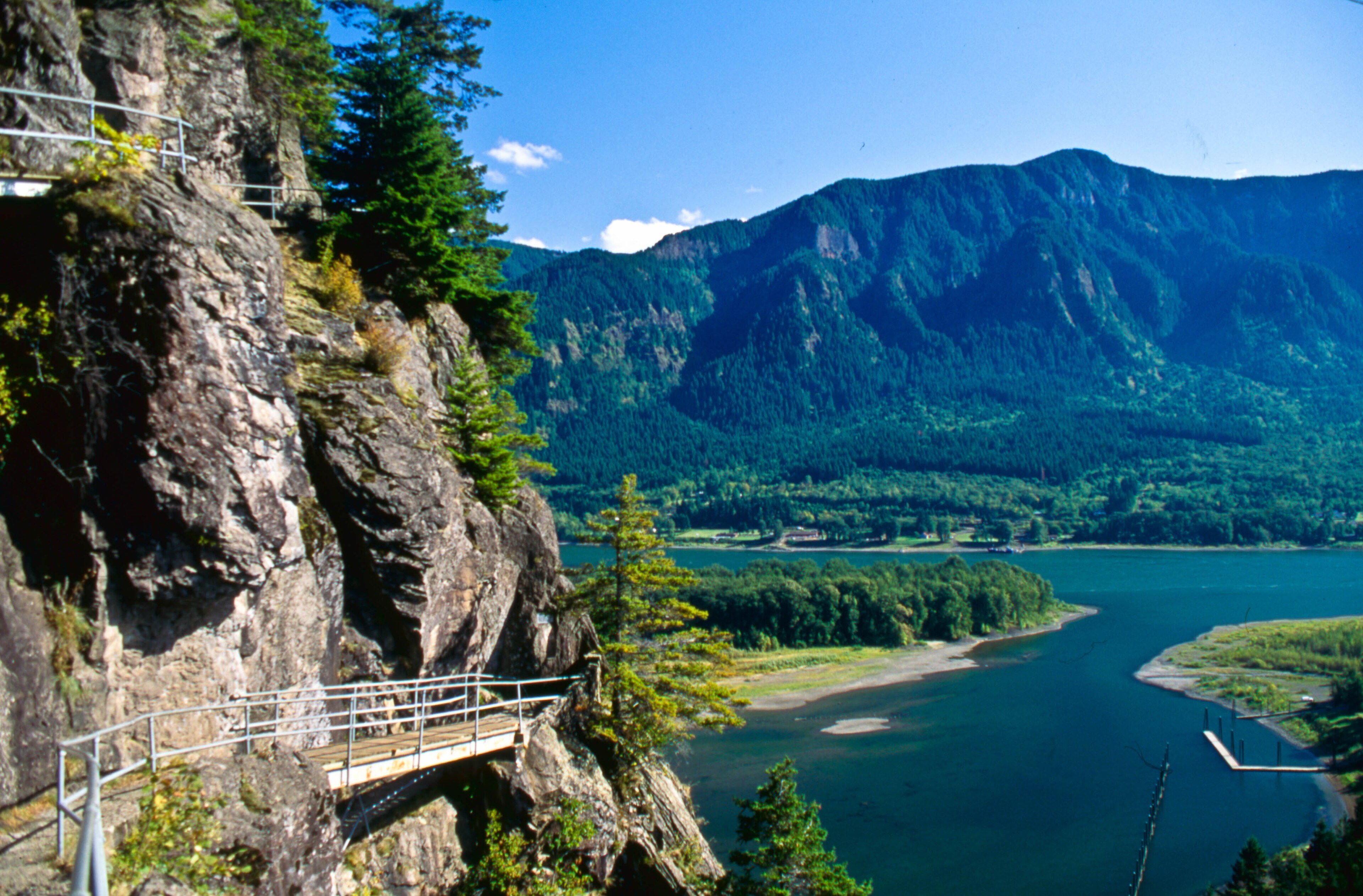
Partway up Beacon Rock — the trail's engineering underfoot: rock, cement, and some seventeen concrete-and-timber bridges bolted straight to the cliff where the natural ledge ran out.
The Bridges Underfoot guide →
05🌲 The Gorge Opens — Looking West
A viewpoint on the climb looking west down the Columbia River Gorge — toward Crown Point and the Vista House, the Oregon peaks, and the islands and wildlife refuge in the river below.
The Gorge Opens — Looking West guide →
06🌲 The Cliff Garden & Its Falcons
The living rock — spring wildflowers like phlox clinging to the ledges, the rare protected plants that closed the east face, a poison-oak warning, and the eagles, jays, and nesting peregrine falcons.
The Cliff Garden & Its Falcons guide →
07🌲 Looking East — Up the River
Near the top, the view east and upriver — the gorge narrowing toward Bonneville Dam and the drowned Cascade Rapids that Lewis and Clark fought down.
Looking East — Up the River guide →
08🌲 The Summit of Beacon Rock
The top of Beacon Rock — a 360-degree view over the Columbia River Gorge, Bonneville Dam, and into Oregon, 848 feet above the river.
The Summit of Beacon Rock guide →
09🔥 The Heart of a Volcano
Stop a second here on the switchback, catch your breath, and put your hand flat on the rock beside you. Go on — feel it. Cool, hard, solid stone. Now let me tell you what you're really touching, because it changes thi…
The Heart of a Volcano guide →- 🥾10
🥾 Into the Forest — Hamilton Mountain Trail (park & walk)
11🥾 Into the Forest — Hamilton Mountain Trail
The Hamilton Mountain Trail on the north side of WA-14 — through old Douglas-fir forest toward Hardy and Rodney Falls. About 1.2 miles in to the falls.
Into the Forest — Hamilton Mountain Trail guide →
12🌲 Hardy Creek & the Living Forest
The heart of the walk — old gorge forest along Hardy Creek, its footbridges and plants, and the wildlife: dippers walking underwater, pileated woodpeckers, black-tailed deer, and banana slugs.
Hardy Creek & the Living Forest guide →
13🔥 The Boys Who Built This Trail
The Civilian Conservation Corps camp at Beacon Rock (1935) — Depression-era young men who hand-built the Hamilton Mountain, Hadley, and Little Beacon Rock trails and the park's facilities.
The Boys Who Built This Trail guide →
14💧 Hardy Falls
The first waterfall on the hike — Hardy Falls, a tall horsetail of Hardy Creek sliding down the mossy rock, seen from a viewpoint just before Rodney Falls.
Hardy Falls guide →
15💧 Rodney Falls & the Pool of the Winds
The heart of the hike — Rodney Falls tumbling in stages past the footbridge, and the short spur up to the Pool of the Winds, a nearly-enclosed cave that breathes wind and mist.
Rodney Falls & the Pool of the Winds guide →
16🌲 The Monolith — Core of a Volcano
Beacon Rock's geology: the 848-foot eroded neck of an extinct cinder-cone volcano, ~57,000 years old, part of the Boring Volcanic Field.
The Monolith — Core of a Volcano guide →
17🌲 The Climbers' Rock & the Falcons
Beacon Rock's sheer south face is a legendary Pacific Northwest rock-climbing wall — and a peregrine falcon stronghold, closed to climbers each spring so the falcons can nest.
The Climbers' Rock & the Falcons guide →
18🔥 Saving Beacon Rock
How Beacon Rock was nearly dynamited into jetty gravel around 1904 — and how geologist Henry Biddle bought it in 1915 to save it.
Saving Beacon Rock guide →
19🌲 The Gorge & the Great Floods
How the Columbia River Gorge was carved — the Ice Age Missoula Floods that scoured it, and why Beacon Rock survived as a hard volcanic core.
The Gorge & the Great Floods guide →
20🌲 Beaten Rock — Lewis & Clark, 1805
Lewis and Clark's 1805 encounter with Beacon Rock, where they first measured the ocean's tide in the Columbia and knew the Pacific was near.
Beaten Rock — Lewis & Clark, 1805 guide →
21🔥 The Town That Moved
How the entire town of North Bonneville picked itself up and rebuilt a few miles west in the 1970s rather than disband when the government took its ground for Bonneville Dam's second powerhouse.
The Town That Moved guide →
22🌲 Bonneville Dam & the Bridge of the Gods
Gorge context east of Beacon Rock — Bonneville Dam, the drowned Cascade Rapids, and the Bridge of the Gods that carries the legend and the old landslide.
Bonneville Dam & the Bridge of the Gods guide →
23🔥 The Bridge of the Gods
The Native legend of the Bridge of the Gods and the real Bonneville landslide that once dammed the Columbia — the story behind the name upstream of Beacon Rock.
The Bridge of the Gods guide →
What you'll see
Tap any landmark for a visitor guide — what it is, where it is, and how to hear its story.
Good to know
- How long is the Beacon Rock: The Rock That Refused to Fall tour?
- The tour has 23 stops over about 7.2 miles with roughly 38 min of narrated audio. You set the pace — pause, linger, or skip ahead anytime.
- Do I need cell signal to use the tour?
- No. Download the tour before you go and it works completely offline — the audio plays by GPS even with no bars, which is exactly where most park tours lose signal.
- How does a self-guided audio tour work?
- You explore the route at your own pace and the Ranger Tales app plays the story for each stop automatically when you arrive, using your phone's location. No tapping, no reading while you explore. Ranger Quinn guides and Ranger Boone tells the campfire tales.
- Where does the Beacon Rock: The Rock That Refused to Fall tour take place?
- Beacon Rock State Park (Columbia River Gorge, Washington). An 848-foot monolith — the core of an ancient volcano — standing over the Columbia River Gorge, with a dizzying trail of catwalks and switchbacks up its face. At its feet, Beacon Rock State Park spreads out with the popular Hamilton Mountain hike up to Rodney and Hardy Falls, the Pool of the Winds, and miles of forest and river trails.
- How do I get the tour?
- Download the free Ranger Tales app from the App Store, then unlock this tour inside the app. The tour downloads to your phone so it's ready offline before you arrive.
- Can I cancel or get a refund?
- Change of mind? Full refund if you request it within 24 hours of purchase. If a verified technical issue prevents access, contact support within 7 days for a refund or credit. All requests are reviewed at our discretion and refunded to your original payment method.
Buy your self-guided tour
Pick a date and book online — checkout is secure, and your unlock code arrives by email. Works offline once it's in the app.
Beacon Rock: The Rock That Refused to Fall — in your pocket
Download the app, unlock the tour, and let it explore with you. Works offline.
Buy the self-guided tour, or get it in the app.
Keep exploring
Drive + walkCarPlayOlympic National Park
142 stops· 2 hr 8 min· 233.0 mi
A self-guided driving and walking tour of the ENTIRE Olympic National Park — three worlds in one journey: glacier-capped mountains, the wettest temperate rainforest in the Lower 48, and seventy-plus miles of wild Pacific coast, all driven on the great horseshoe of Highway 101 from Port Angeles down to Lake Quinault. Ranger Quinn guides you up every spur — Hurricane Ridge and Mount Olympus, the freed Elwha River, blue Lake Crescent, Sol Duc Falls, the Hoh Rain Forest, Rialto and Second Beach, Ruby Beach, the Kalaloch coast, and the Valley of the Rain Forest Giants — while Ranger Boone Merrick tells the tales that matter: the Lower Elwha Klallam who freed their river in the largest dam removal in American history, the Lady of the Lake, the Quileute's Move to Higher Ground, the Makah village the sea kept at Ozette, the two Roosevelts who built the park around its elk, and the world's largest spruce. This is the ancestral homeland of eight living, sovereign nations who steward it with the park today. The park interior is roadless, so you drive the perimeter and turn up the spurs; the tour plays whichever end you start from, by GPS. Around thirty dollars a vehicle gets you in for a week; cell signal dies past Port Angeles, so it works fully offline. On the coast, the tide can trap you and rolling drift logs kill — carry a tide chart and never turn your back on the ocean. 2026 note: some roads are gated by washout or fire (the Elwha beyond Madison Falls, Rialto's Mora Road in late season, the Quinault South Shore loop, Staircase) — the tour routes what's open and tells you the rest honestly; check the park's road line before you go.
Driving tourCarPlayHocking Hills — Caves, Cliffs & Waterfalls
38 stops· 1 hr 9 min· 28.4 mi
The flagship tour of Hocking Hills — six legendary stops strung along one winding scenic byway, driven at your pace with a walk at every one. Start at Cantwell Cliffs, the rugged corner most visitors miss, and squeeze down a crack in the rock the locals named a century ago. Stand inside Rock House, the only true cave in these hills — a corridor in the cliff with great arched windows where outlaws and bootleggers once kept house, so the story goes. Walk the hush of Conkle's Hollow, a boardwalk gorge beneath walls of two hundred feet, where pioneer legend says a robbers' treasure is still up on the ledge. Give the centerpiece its due at Old Man's Cave — waterfalls, the Devil's Bathtub, stone bridges raised by the CCC, and the great recess cave where the hermit Richard Rowe lived out his days with his dogs. Catch the biggest water in the hills at Cedar Falls — named by settlers who couldn't tell a hemlock from a cedar — and finish in the grandest stone room in Ohio: Ash Cave, a seven-hundred-foot amphitheater sheltering ten thousand years of human firelight, where Ranger Boone closes the day with the story of Grandma Gatewood, the sixty-seven-year-old Ohio grandmother who out-walked everyone who doubted her. Ranger Quinn guides; Boone stops you seven times for the deep stories. The park is free; the tour works fully offline — exactly what these no-signal hills require. Works in either direction, north or south. Good shoes recommended; every walk is under ninety minutes and one is fully wheelchair-accessible.
Driving tourCarPlayThe Mohawk Trail
36 stops· 53 min· 49.1 mi
Fifty miles of the Mohawk Trail — Massachusetts Route 2 — the marquee New England fall-foliage drive and, back in 1914, the very first road in the country built purely for the pleasure of the view. It climbs out of the Connecticut River valley at the great French King Bridge, up through Shelburne Falls and Charlemont into the Berkshire hills, over Whitcomb Summit and around the white-knuckle Hairpin Turn, and down into North Adams and Williamstown under the shadow of Mount Greylock. Ranger Quinn keeps you oriented and safe and tells you what you're seeing — the river gorge, the flaming maples, the old summits and their four-state views. Ranger Boone Merrick brings the tales this old road has carried for a thousand years: the Native 'Great Path' that came first, the French scout who named a rock in the river, the winter the whole town of Deerfield was marched to Canada, the railroad tunnel they called the Bloody Pit, and the mountain a novelist watched like a sleeping whale while he wrote Moby-Dick. Drive it either way. Best in late September and October, when the hills catch fire. Roll.